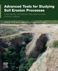
Advanced Tools for Studying Soil Erosion Processes: Erosion Modelling, Soil Redistribution Rates, Advanced Analysis, and Artificial Intelligence
Pourghasemi, Hamid Reza
Kariminejad, Narges
Advanced Tools for Studying Soil Erosion Processes: Erosion Modelling, Soil Redistribution Rates, Advanced Analysis, and Artificial Intelligence presents the most recent technologies and methods in quantifying soil erosion, focusing on quantitative geomorphological assessment, soil erosion interaction with natural and man-made hazards using new methods, and technologies that employ GIS, remote sensing (RS), spatial modeling, and machine learning tools as an effective plan for decision-makers and land users.Organized into three parts: 1) Erosion processes and impacts, 2) Advanced computing techniques to quantify soil erosion, and 3) Methods of Soil Erosion, this book will be an invaluable source material for researchers, academicians, graduate and undergraduate students, and professionals in the field of geology, specifically focused on geographic information systems and remote sensing. Provides an overview of soil erosion and its interaction with natural hazards (i.e., geological, hydrological, meteorological, and biological)Introduces advanced tools and technologies in soil erosion managementPresents future soil erosion opportunities and challenges INDICE: Part-I - Erosional processes and impacts 1. The form of water erosion (includes sheet, rill, and gully erosion) together with their interaction 2. Global soil erosion, restoration, desertification, and land degradation under changing environmental conditions 3. A world with and without soil erosion: the past, present, and precarious future of surface and subsurface erosion 4. The importance of both quantity and quality of soil data for use of the different approaches 5. Restoration of soil affected by non-sustainable soil erosion rates 6. Where subsurface and surface runoff occur in the landscape and cause soil erosion? 7. A combination of experts of many fields (including social scientists) to prevent erosional hazards 8. The impact of geomorphological hazards (i.e., mass movement/landslides) on soil erosion 9. The impact of hydrological hazards (i.e., floods) on soil erosion 10. The impact of climate hazards (i.e., climate changes and global warming) on soil erosion 11. Pictures or videos of erosion features and links to open access tools/models Part-II - Advanced/computing techniques to quantify soil erosion 1. Artificial intelligence including Machine learning and Deep learning algorithms 2. Google earth engine platform 3. Remote sensing and satellite imageries 4. Aerial robotics including unmanned aerial vehicles (UAVs) 5. Web-GIS 6. Land-based sensors7. Geophysics tools (i.e., GPR, ERT) 8. Internet of things (IoT), and analyzing big data (BD) 9. Open-source software tools 10. Tracing or radio-isotopic techniques (e.g., cesium-137) used to reconstruct soil redistribution rates Part-III - Methods of soil analysis 1. Soil erosion modelling, mapping, and its spatial-temporal variability 2. Susceptibility, hazards, and risks of soil erosion 3. Opportunities and challenges for future of soil erosion 4. The strengths and weakness of applying advanced technologies in soil erosion research 5. Geophysical detection of surface and under surface soil erosion 6. Distributed soil modeling and digital soil mapping-DSM 7. Evolution in erosional landforms and their importance (past-present-future) 8. Spatio-temporal conceptual models of soil erosion 9. The importance of input data and their accuracy in soil erosion assessment 10. Early warning systems for monitoring and managing soil erosionAppendix Index Abbreviations
- ISBN: 978-0-443-22262-7
- Editorial: Elsevier
- Encuadernacion: Rústica
- Páginas: 650
- Fecha Publicación: 01/08/2024
- Nº Volúmenes: 1
- Idioma: Inglés
